Fossil Record File
What is the Fossil Record File?
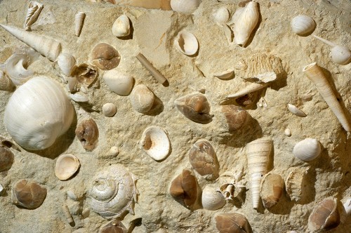
One of the defining qualities of GSNZ that sets it apart from all other geological societies is its joint ownership (with GNS Science) of a national research database known as the New Zealand Fossil Record File (FRF). This is a register of tens of thousands of fossil localities, mostly from mainland New Zealand but also including our offshore islands, and many from elsewhere in the Pacific, Antarctica, and other places as well.
The FRF was begun as a paper-based file in the 1940s, but was migrated to various computer platforms in the 1970s, and can be accessed today via the web application FRED. Access to FRED is free but use requires registration.
The New Zealand Fossil Record File is the envy of most other earth science communities globally. There is nothing quite like it anywhere else. Currently there are more than 100,000 fossil localities on record, and more than 1,000,000 individual occurrence records. The number of records grows monthly.
Administration
The FRF is physically administered by six curators who are based in universities or GNS offices throughout the country. Present curators are based at the University of Auckland, GNS Science Lower Hutt and Dunedin, Victoria University of Wellington, University of Canterbury and University of Otago.
Day to day management and operation of FRED is carried out by GNS at its Lower Hutt office.
What is the role of GSNZ?
The roles of GSNZ and GNS Science are documented in a Memorandum of Understanding (2016). In broad terms, GNS Science provides the technology platform and associated maintenance, while the role of GSNZ is to promote use of the system for the benefit of the New Zealand earth science community, and to advocate on behalf of the user community.
The FRF Advisory Group
The FRF Advisory Group comprises four people, two each from GNS and the GSNZ, who provide strategic direction for the FRF.

Haughs Quarry
Geoheritage Sub-committee
Please note that the New Zealand Geopreservation Inventory is temporarily offline. If you have any questions relating to this valuable resource please contact Bruce Hayward who will endeavour to help you.
The Geoheritage Sub-committee is concerned with the identification and protection of the best representative geological features and landforms of New Zealand. During the 1980s and 1990s, the subcommittee oversaw the completion of a New Zealand Geopreservation Inventory, which identified, listed, graded and documented c.3,200 different geological features under different subject categories and subsequently according to geographic region. The Inventory is not a static listing and is continually being upgraded and reassessed as new information comes to hand.
The subcommittee maintains a watching brief on the welfare of important geological sites and landforms around the country and periodically makes submissions on Regional and District Plans and RMA permit requests to undertake works that may be detrimental to New Zealand's earth science heritage.
A document explaining what Outstanding Natural Features are (as referred to in the RMA) and giving criteria for assessing their significance is available as a GSNZ Miscellaneous Publication (MP154).
The New Zealand Geopreservation Inventory is available free for all to use from our GIS web site.
Any member with an interest in Geoheritage is welcome to join the subcommittee and should contact the GSNZ Administrator in the first instance.
